
Planex logo
Urban Planning Platform

Model, test, and understand urban change with confidence

Planex is built to help teams design, analyze, and simulate urban environments. Its core component, Urban Simulator, lets you run scenario-based simulations using spatial and table-based inputs. The platform also includes Built-up Change Analyser, which uses multi-epoch GHSL data to reveal long-term changes in built-up surfaces.
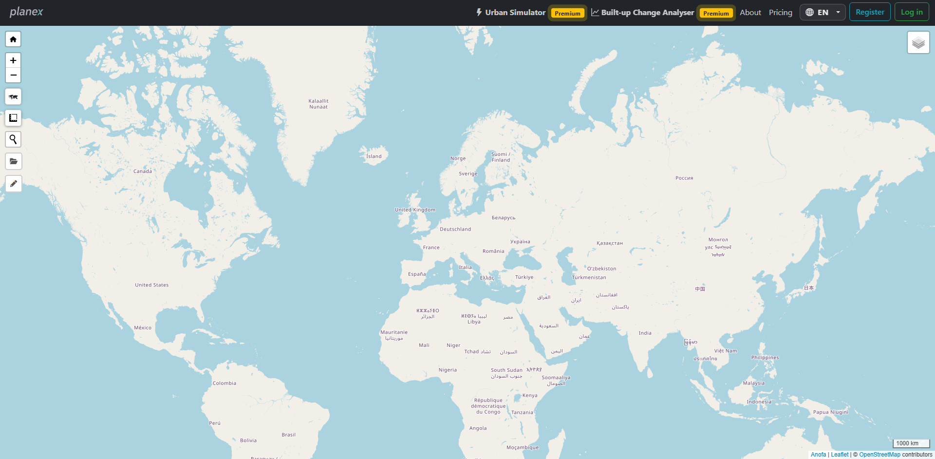
Planex Urban Simulator interface

Urban Simulator

Urban Simulator is the center of Planex. It supports a clear workflow for setting up inputs and running simulations for urban planning scenarios.

1) Upload Spatial Inputs

Upload land-use data in GeoJSON, zipped Shapefile, KML/KMZ, GPX, DWG, DXF, or DGN format to initialize the simulation.

2) Add or Generate a Road Network

Upload a road network, retrieve OpenStreetMap roads, or generate a predefined network pattern directly in the simulator.

3) Run and Evaluate

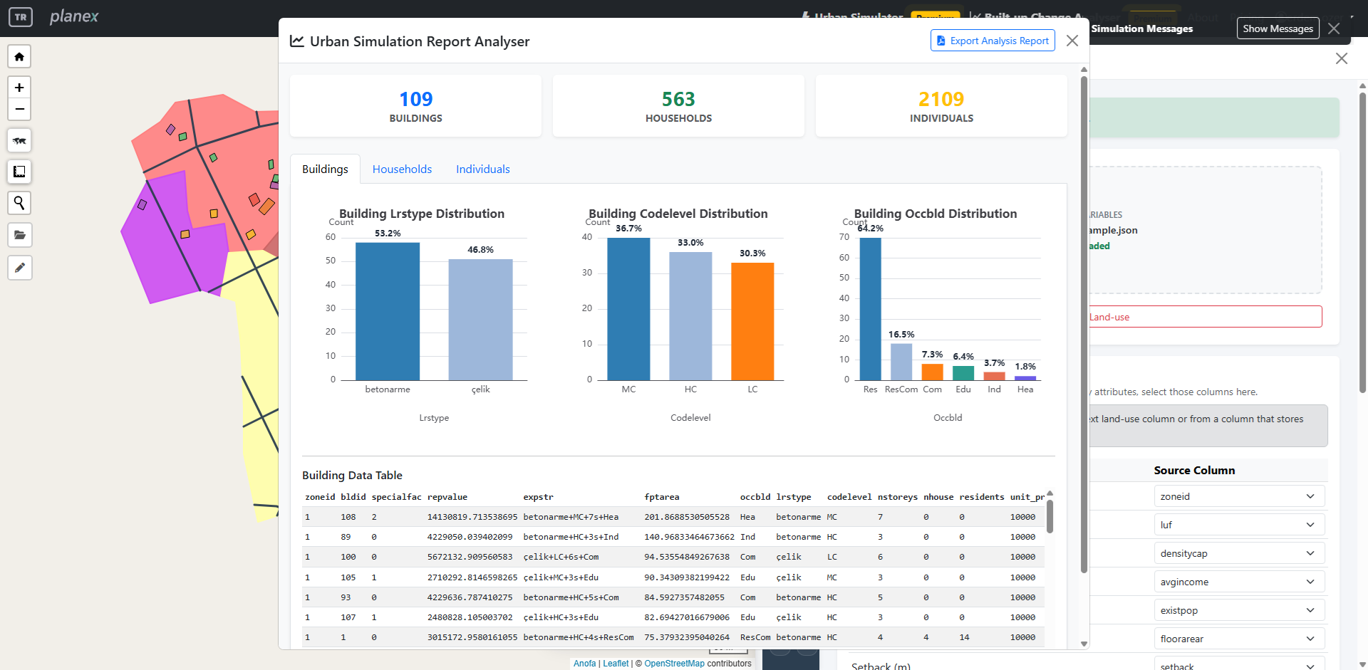
Complete the parameter tables, run the scenario, review spatial and socio-demographic results, and export the generated outputs.
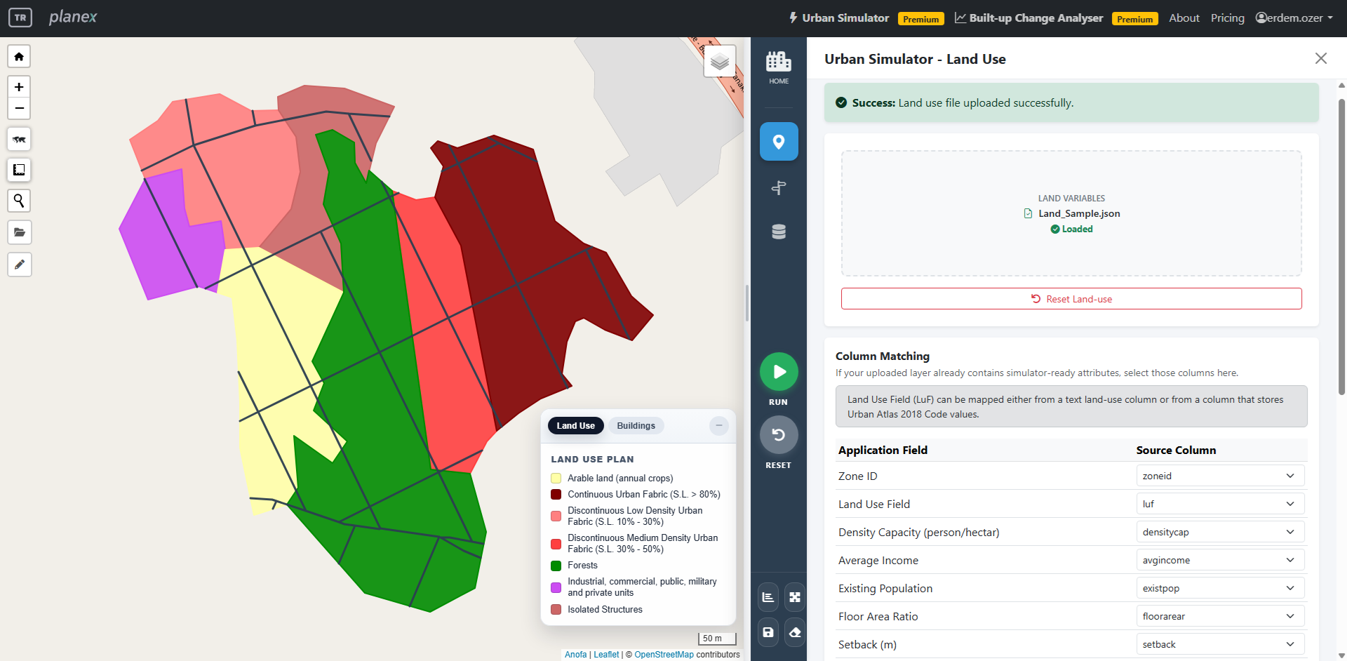
Urban Simulator land use upload setup
Urban Simulator map and simulation outputs

Modelling and Methodological Foundation: Urban Simulator

In Planex, Urban Simulator is not only a map-based drawing tool. It is a synthetic urban system generator where geometry and tabular socio-demographic outputs are produced consistently from logic/distribution tables.

  • Logic tables are used to estimate household counts, household size distributions, income groups, gender, age, and education attributes, then generate linked household and individual records.
  • Residential, mixed-use, commercial, industrial, school, and hospital building inventories are generated from zone constraints and tabular parameters, including footprint ranges and storey logic.
  • Footprint placement uses geometric rules from land-use polygons and setbacks, plus optional road network clipping and road setback buffers to define valid placement areas.
  • Building rectangles are rotated to align with parcel or road segment angles, then filtered by containment and collision checks so generated geometries remain feasible in-zone.

Built-up Change Analyser

Built-up Change Analyser examines long-term changes in built-up surface intensity using ready-to-analyse GHSL layers—without requiring users to prepare or upload raster imagery.
What it does

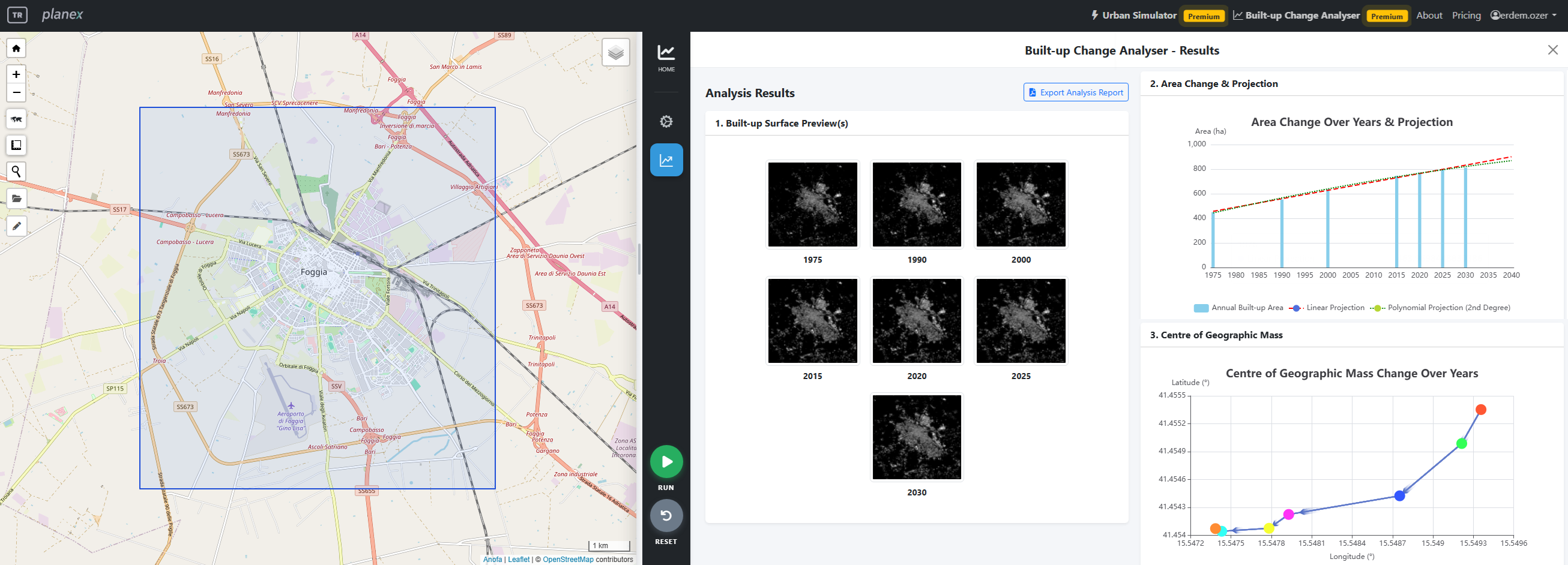
  • Draw a rectangle on the map to define a custom analysis area.
  • Automatically retrieve seven GHSL built-up surface epochs from 1975 to 2030.
  • Review 100 m built-up surface previews and total built-up area in hectares.
  • Compare historical, recent, and projected epochs with indicative trends through 2050.
  • Track the weighted geographic centre of built-up surface and export a PDF report.
Built-up Change Analyser results and charts

Data and Methodological Foundation: Built-up Change Analyser

Built-up Change Analyser uses the European Commission Joint Research Centre's GHSL GHS-BUILT-S R2023A product to compare built-up surfaces across multiple epochs.

  • Users select an area on the map; Planex retrieves the required GHSL coverages automatically, so no multi-year raster imagery upload is needed.
  • Each 100 m raster cell represents estimated built-up surface in square metres. Values describe built-up intensity or extent within the cell, not a binary built-up mask.
  • The analysis covers 1975, 1990, 2000, 2015, 2020, 2025, and 2030. The series combines observation-supported anchors with interpolated and extrapolated epochs; 2025 and 2030 are not direct observations.
  • Cell values are summed to calculate total built-up surface in hectares, while value-weighted coordinates show how the geographic centre of built-up mass shifts over time.
  • Linear and polynomial trends are extended to 2050 for exploratory comparison. These projections are analytical trend outputs and should not be interpreted as observed conditions.

Product Overview

See Urban Simulator in action and explore the renewed GHSL-based built-up change workflow.

Urban Simulator

Built-up Change Analyser

Start Exploring Planex

Move from scenario-based urban simulation to long-term GHSL built-up change insights within one planning platform.

Launch Planex